Google Heat Maps
Google Heat Maps
Google Heat Maps
Integrated Campaign
Integrated Campaign
Finding the coolest routes on the hottest days.
Rising temperatures are putting vulnerable people—like expectant mothers and the elderly—at risk. In a big city like New York City, the heat can feel inescapable, and navigating it is unpredictable without knowing where to find relief. Google Heat Maps changes that with a new Google Maps feature designed to help users find the coolest routes on the hottest days.

How It Works
How It Works
Using infrared mapping and real-time temperature data, HeatMaps flags the hottest areas—from streets to subway platforms—and suggests cooler alternatives. Color-coded temperature icons guide users, factoring in platform wait times, tree coverage, and building shade to keep every step of the trip cooler and safer.
Using infrared mapping and real-time temperature data, HeatMaps flags the hottest areas—from streets to subway platforms—and suggests cooler alternatives. Color-coded temperature icons guide users, factoring in platform wait times, tree coverage, and building shade to keep every step of the trip cooler and safer.
Using infrared mapping and real-time temperature data, HeatMaps flags the hottest areas—from streets to subway platforms—and suggests cooler alternatives. Color-coded temperature icons guide users, factoring in platform wait times, tree coverage, and building shade to keep every step of the trip cooler and safer.


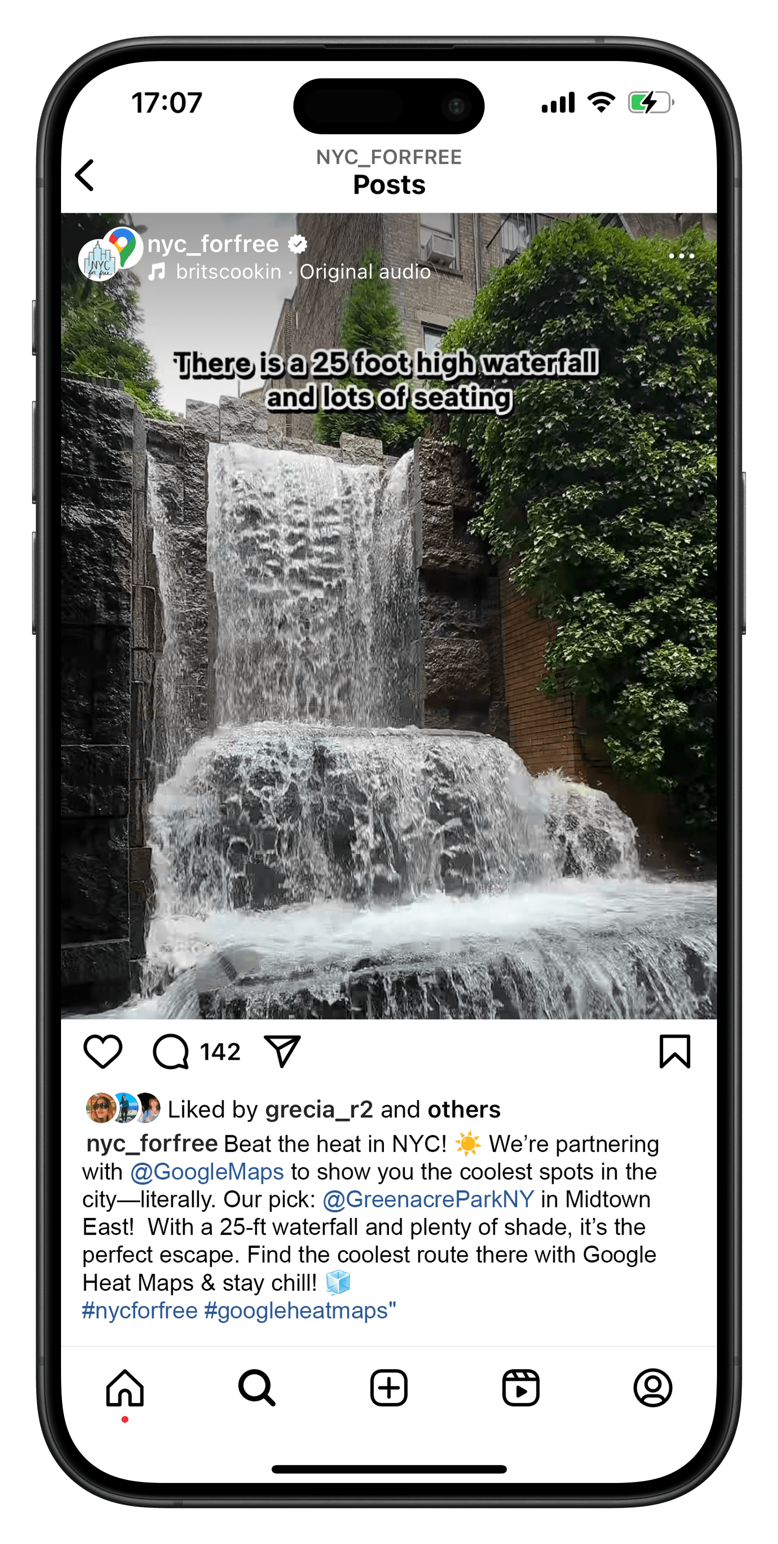
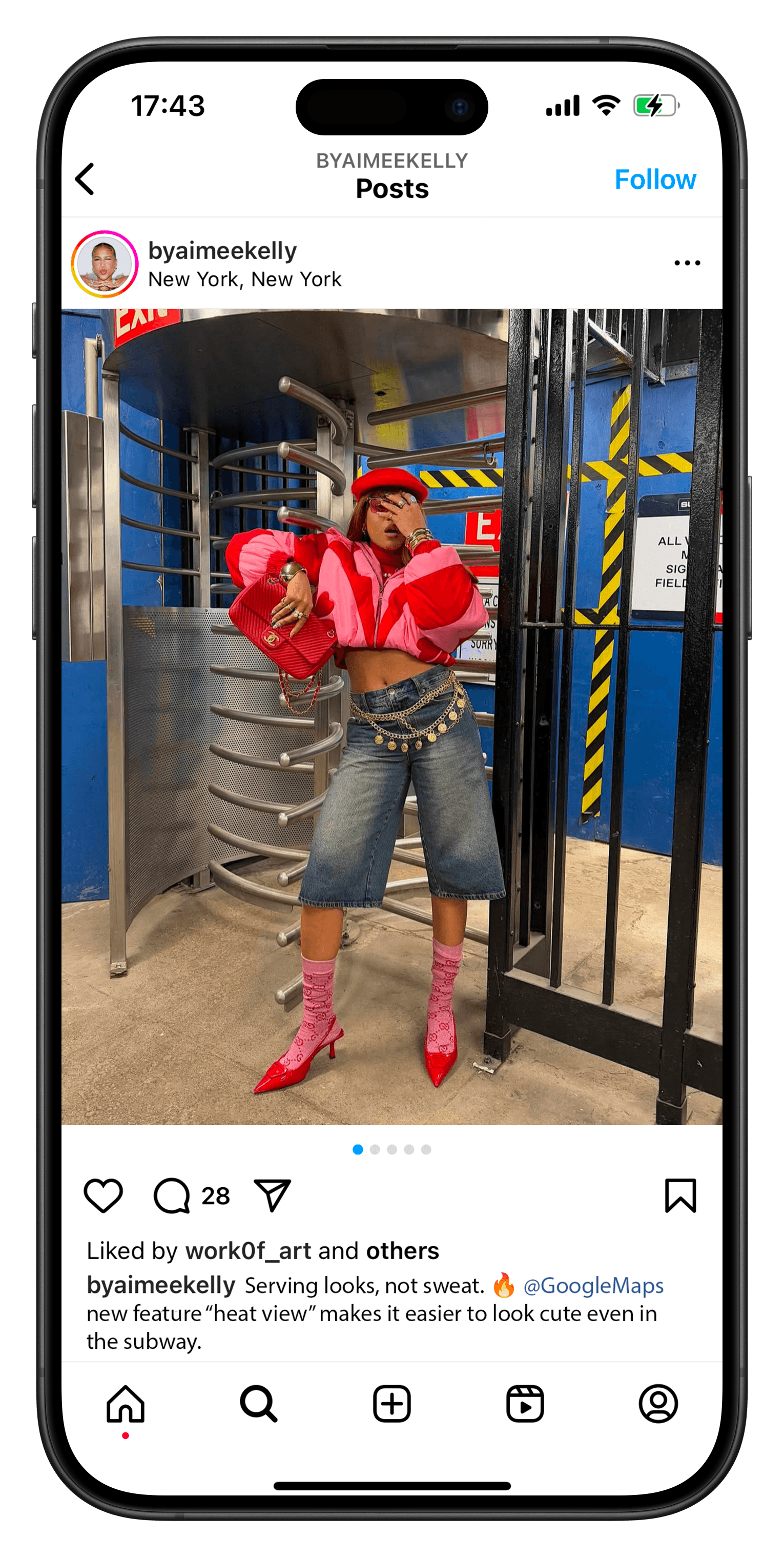
Social Series
Social Series
We'll team up with NYC creators for a social series, 'Coolest Places in NYC'. They’ll take us to their favorite summer spots—hidden gems, rooftop pools, underground bars—and show how to get there without breaking a sweat, thanks to Google Heat Maps.
We'll team up with NYC creators for a social series, 'Coolest Places in NYC'. They’ll take us to their favorite summer spots—hidden gems, rooftop pools, underground bars—and show how to get there without breaking a sweat, thanks to Google Heat Maps.
We'll team up with NYC creators for a social series, 'Coolest Places in NYC'. They’ll take us to their favorite summer spots—hidden gems, rooftop pools, underground bars—and show how to get there without breaking a sweat, thanks to Google Heat Maps.
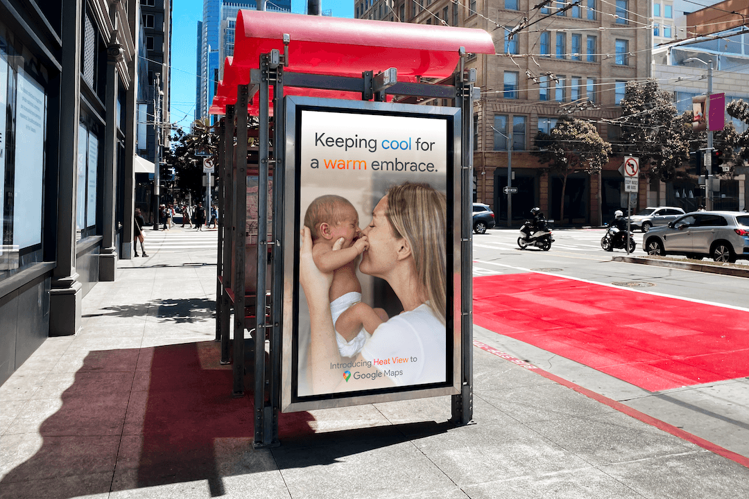
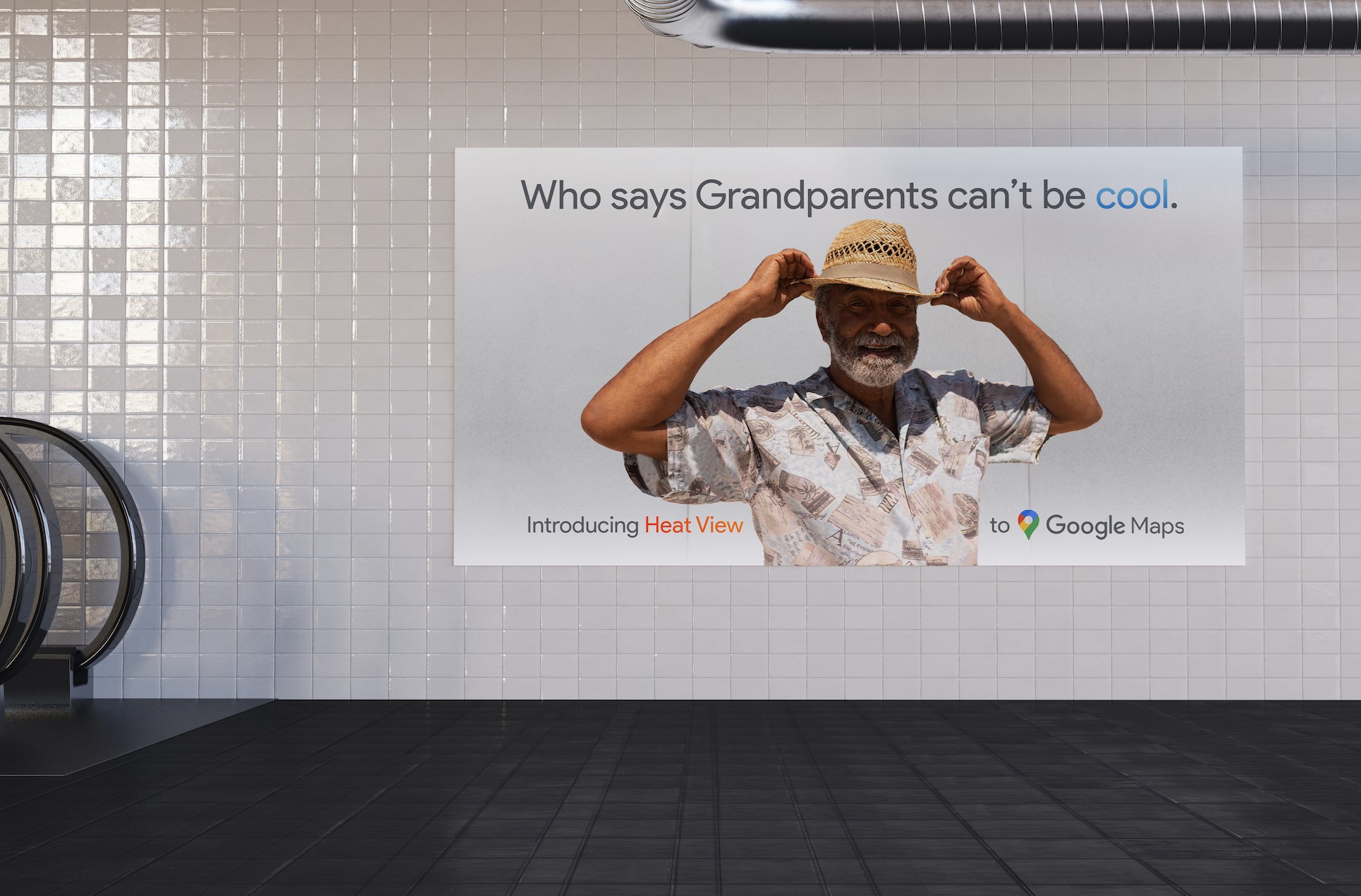
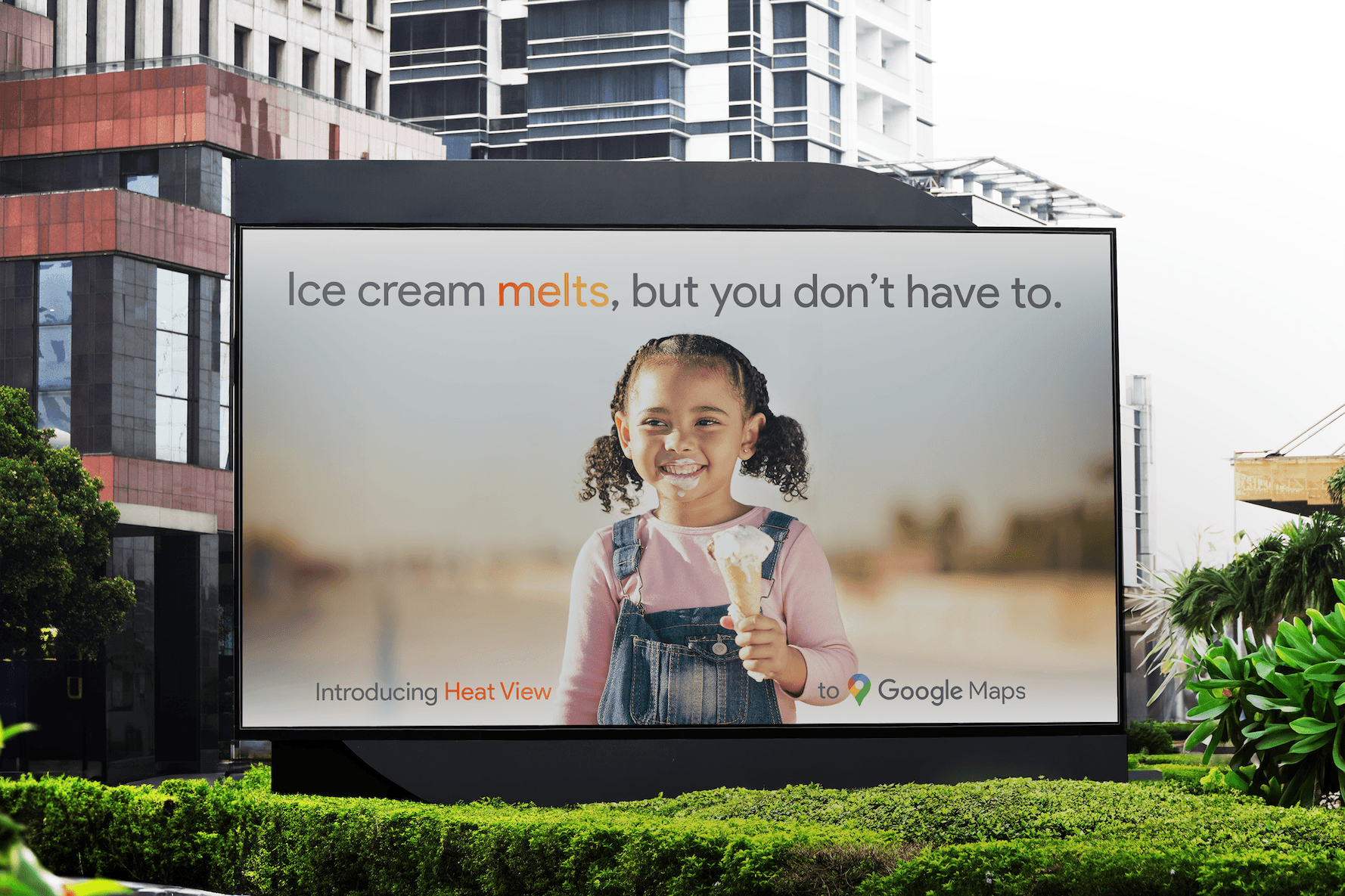
Out Of Home
Out Of Home
To promote the feature, out-of-home ads will spotlight how Google HeatMaps helps vulnerable travelers stay safe—especially in areas known for extreme heat.
To promote the feature, out-of-home ads will spotlight how Google HeatMaps helps vulnerable travelers stay safe—especially in areas known for extreme heat.
To promote the feature, out-of-home ads will spotlight how Google HeatMaps helps vulnerable travelers stay safe—especially in areas known for extreme heat.
CREDITS
May Ruzicka - Art Director / Videographer / Editor / Copywriter
AWARDS
Graphis New Talent 2025 - Gold
AWARDS
Graphis New Talent 2025 - Gold